Sunday, 6 September 2009
Case Study Template for A2 Unit 4 Tectonic Activity
Remember the four areas:
1. Causes
2. Physical impact
3. Human impact
4. Response
Your colour coding system should be well established by now, and will help you to quickly identify the four key areas within your research.
Thursday, 23 July 2009
Little Britain: If the UK was a village of 100 people...
 The Daily Mail has trawled acres of spreadsheets and data-sets published by government and other statistical authorities to produce a snapshot of Britain in the 21st century. Here are just a few statistics:
- EACH person would generate 495kg of waste every year. The village would generate 163kg of waste every day, of which just 47kg would be put out for recycling.
- THE villagers would have 118 mobile phones among them (66 of which would be pay-as-you-go).
- TWENTY-ONE villagers would have watched Andy Murray beat Stanislas Wawrinka at Wimbledon this year; 32 people would have watched Susan Boyle lose Britain's Got Talent.
- THIRTY people would have a Facebook account.
- THERE would be a total of 74 voters, but only 26 of them would have gone to the polls at this year's European elections.
Wednesday, 22 July 2009
Breathing Earth
I had forgotten about this great site until I saw it mentioned on Funky Geography. It is a simulated world map showing the CO2 emissions and birth and death rates by country happening in real time.
New Zealand moves closer to Australia!
See the full BBC report here.
Sunday, 19 July 2009
650 million years in one minute!
650 Million Years in 1 Min. and 20 Sec. - Watch more Funny Videos
Saturday, 4 July 2009
Coastal Management at Sidmouth
Sidmouth seafront west in England
Monday, 22 June 2009
Glacier melt changes Italian border
Thursday, 28 May 2009
A2 Level: Issues Analysis (synoptic)
1. Tourism in the Cairngorms, Scotland (from SAC - Scottish Agricultural College).
The Cairngorms became Scotland's second National Park in September 2003. The area is also used for a number of tourism activities.
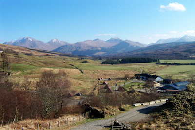 The Cairngorm funicular is a means of transport, pulled by cables over a track bed, allowing visitor access from the car park area up the mountain plateau. It was designed primarily for winter sports enthusiasts (skiers and snow-boarders) to replace the outdated chairlift system, but is in use all year round. In summer, however, visitors are not allowed to leave the restaurant viewing platform area, due to the potential damage their walking would inflict on the fragile mountain environment and local ecosystem. Much controversy surrounded the granting of the permission for the development to take place, with heated conflicts between conservationists and the developers.
2. The Cairngorms Campaign
The Cairngorms Campaign is a membership organisation, welcoming individuals and groups as members who support its aims of protection and appreciation of the area. The Cairngorms Campaign strives to prevent unsustainable, damaging developments and argues for better management of the Cairngorms area. It works with landowners, managers, local authorities, government and agencies to this end.
3. Building ban on second homes in the Cairngorms - Times Online
WEALTHY outsiders are to be banned from building new holiday homes in the Cairngorms National Park under plans aimed at stopping rural communities from becoming tourist “ghost towns”.
The park wants to restrict the sale of new housing within its 1,467-square-mile boundaries to people who live, work or have family links in the area. It means that outsiders will no longer be allowed to buy or build new housing for use as second homes or as holiday homes for rent.
The Cairngorms is Britain’s largest national park, with a vast mountain wilderness at its heart. It encompasses large areas of the Highlands, Moray, Aberdeenshire and Angus and is home to 17,000 people and 25 per cent of Britain’s threatened species.
Its spectacular scenery is a magnet for tourists, but in property terms has resulted in an epidemic of wealthy second-homers, who now own one-in-five of all houses within the park. That figure rises to about half in some small villages such as Braemar. The knock-on effect has been a steep rise in property prices, up by as much as 13 per cent a year, placing even the most modest, semi-detached family home beyond the financial reach of locals.
GCSE: Terminal examination on Tuesday 2nd June
Examiners tips (from 2007 and 2008 Examiners reports)
a) Where two suggestions/ideas are asked for, use two paragraphs. Remember the framework, write your first idea followed by a detailed explanation. Then, in a new paragraph, write your second idea followed by a detailed explanation.
b) Use PEE (Point, Evidence, Explanation) paragraphs for parts c, d and e of each question.
c) Practise diagram skills - can you draw sketch maps or diagrams to show volcanoes, regional differences, how global warming is caused, types of rainfall etc? Remember labels!
d) Use the first 5-10 to carefully select the best 4 questions to answer (remember, 2 questions from Section A, 1 question from Section B and 1 question from Section C).
e) Don't stereotype or generalise and have some idea of where places are - the South of Italy is NOT an LEDC, Africa is NOT a country. Know where your case studies are and be able to use the correct geographical area example.
f) Know key vocabulary, for example, economic activity, climate, physical processes. Remember that the Ozone layer is nothing to do with global warming!
g) Short and snappy answers for 2 mark questions - not paragraphs!
h) Look at command words and target the precise wording - son't just regurgitate all you know about a particular case study.
(Thanks to Mr Gurney for putting this list together)
Bearing in mind that natural hazards always appears in both Section A and Section B, make sure that you revise it in detail. Check the tectonic activity section of Bitesize. Pay special attention to the diagrams of volcanoes as we did not cover that very much in the lesson time. Make sure you know the diagrams of the plate boundaries and labels to go with them. You are often asked to explain in your labels, so they need to be good quality! Also, check the section on managing tectonic activity.
Use of your green revision guides for OCR C Geography. Not one question will be a surprise tomorrow if you have made good use of the revision guide!
To remind yourself of the layout of the exam paper and see some example questions, there is a higher tier paper here.
Some of you were requesting more of the case study templates last week. Although we had no more photocopied, don't forget that you can download a copy from here...
Case Study Template for GCSE
GCSE: DME on Tuesday 9th June
Sunday, 19 April 2009
Tower block adverts
Friday, 17 April 2009
Edexcel AS Geography: Global Hazards
Global Hazards Edexcel AS Revision
There be pirates...
I have made a movie to go with the lesson.
Some useful BBC News clips...
Somali pirates seize another boat
Pirates continue to hold hostages
On the trail of Somali pirates
Monday, 6 April 2009
Earthquake in Italy
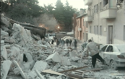 At least 27 people have been killed in a powerful earthquake that struck central Italy.
Five children are said to be among the dead and at least 30 people remain unaccounted for as a massive search for the trapped is under way.
The 6.3-magnitude quake struck in the early hours close to the medieval city of L'Aquila, 95km (60 miles) from Rome.
A civil protection official told the BBC that 3,000 to 10,000 buildings in the city may have been damaged.
To see the rest of the BBC report, click here.
Early report from CNN...
And from the BBC...
Sunday, 22 March 2009
Year 12 Fieldwork Weekend: Day One (Urban Rebranding)
1. Haven Banks
The day began with a visit to Haven Banks, a waterfront location along the River Exe that has been redeveloped into small independent retail outlets and a complex of flats/apartments. A 3-bed flat in this area is currently for sale for nearly £300,000. There is also a water activities centre operating from this location. There was still evidence of many redundant warehouses from the 1800s and early 1900s which were used in the trade of wool, cement, oil, timber and other goods. Ironically, we stood discussing some of these issues in front of a building site marketing new-build 1 and 2 bedroom flat, next to an empty and derelict warehouse which was ripe for redevelopment. We carried out Environmental Quality and Housing Quality bi-polar surveys, as well as an assessment of the success of this areas regeneration.
2. Exeter Quay
We crossed the foot bridge to the other side of the River Exe, to have a look around Exeter Quay. This is an example of an area that has been rebranded for tourism. We were noting any features of the 'old' quayside and how it's 'new' rebranding targeted the tourist visiting Exeter. This ranged from the visitors centre, to cafes, retaurants, the small ferry that links the Quay to Haven Banks and the cobbled streets and pedestrianised areas. It was also worth noting the approach of the rebranding, mixing the history of the quay with the new image - the history of the area is still strongly felt. The slow deterioration of the Quay began in the mid 1800s when the railway started to replace the use of the canal for transporting goods. Here, students repeated their exercise, looking at the housing and the quality of the environment. We established that the housing around this area, known as Shilhay, was a contrast to the relatively more expensive Haven Banks area. There's an array of council owned accommodation and sheltered housing. It was a surprise to see that so many of the clubs on the quay had closed down - this area is well known as the hub of Exeter's nightlife. Some students were looking at the average age of the cars, to make comparisons with other areas later in the day.
 3. Princesshay
On 13th February 2009, The Herald reported that 'LAND Securities "in partnership with Exeter City Council" spent £225m to develop the new Princesshay, bringing over 500,000 square feet of retail space, 60 shops, seven restaurants, 123 apartments and 500 parking spaces to our city.' (see the whole report here).


Students continued to collect their data regarding the environment and the housing (part of the redevelopment has included new apartments above the stores). They also carried out perception surveys, asking people using Princesshay what they thought of the redevelopment. Students had also preprepared their own means of assessing the sustainability of the city centre. There's already a notable exodus of shops from the Princesshay centre, including Zavvi, Barratts and USC.


4. High Street
After visiting the new Princesshay, we made a direct comparison with the High Street, which runs parallel to the new development. Many buildings are now empty as a result of both the current economic situation and the fact that the larger chains moved into the new development. Next and Debenhams were the two stores that acted as the anchor to the new Princesshay - with Next having the prime location and iconic design at the entrance to the High Street. However, opposite the Next store is the empty shell of the old high rise Debenhams store, as well as many other empty stores. In 2005, Exeter topped the list of clone towns in the UK, with only one out of 50 stores in the High Street being independent, the rest chain stores. (See the BBC report here.)


5. Sidwell Street
To finish, we went to a street that is in need of some regeneration - Sidwell Street. It does contain many more independent stores and a steet market, but has many visible signs of decline, including buildings in a poor state of repair, damaged pavements and graffiti. This street is only yards away from the iconic Next store, yet is a stark contrast.


When we were returning to the minibus, we went past the new Vue cinema complex and the construction of a new hotel in the same area, both examples of the reimaging of Exeter.

Here is a copy of the fieldwork booklet that we used on the day. I adapted it from various resources shared on the Edexcel Geography Ning (with thanks to those people who shared their primary data techniques).
Tuesday, 3 March 2009
Adaptation (another catchy tune!)
Friday, 27 February 2009
Global Rich List: How rich are you?
 Every year we gaze enviously at the lists of the richest people in world. Wondering what it would be like to have that sort of cash. But where would you sit on one of those lists? Here's your chance to find out, go to the Global Rich List.
Tuesday, 24 February 2009
Year 10 ICT lesson: Revisiting Development
What to include?
1. Use gapminder (click on 'Gapminder World') to explore any relationships between your development indicator, and other indicators of development. Use the drop down lists on the two axis to select your indicator and the one(s) that you want to compare with. Include a copy of any graphs that you have created, and write a description to describe and explain what it shows.
2. Use worldmapper to create a map of your development indicator and its global pattern. Again, make sure that you include a copy of the map, with a description and explanation of what it shows.
3. Use CIA World Factbook to create a list of 8 countries and the data for that country related to your indicator. Are there any patterns? Are there any that do not fit a pattern? Why might this be? Some of you will be able to create a graph to show the data you have researched.
4. Finish your PowerPoint with 3-5 bullet points that summarise what you found out about your development indicator.
Saturday, 21 February 2009
Google Earth 5
Friday, 20 February 2009
Real life 'Slumdog Millionaire'
 I don't seem to be able to see anything any more without thinking about how it might be useful in our Geography lessons. I went to see Slumdog Millionaire a couple of weeks ago, as I've already discussed with some of you! I've been thinking about how best it can be used and have contemplated reinventing the 'Are the streets of Kolkata paved in gold?' unit to reflect Slumdog Millionaire instead but will have to wait until the DVD is released. Athough it is a 15 cert, it would be possible, with some careful scene selection and parental consent, to craft a new unit of work around this film for the year 9 curriculum! Scenes that are particularly relevant include one where the children are running through the slums, as well as one in which call centre staff are being trained in 'Britishness' almost, by learning about Kat and Alfie in EastEnders!
BBC News reported the real life slumdogs and featured the child stars of the film who were paid £3,000 each. Let's remember this is a film that has made $140 million at the Box Office! Watch the report HERE.

Thursday, 19 February 2009
Another mobile phone fact!
Thanks to Alan Parkinson.
Wednesday, 18 February 2009
Geography and technology: The evolution of mobile phones
 The Geography department is soon going to be working together with the Technology department on a project that covers both subjects (cross curricular). One direction we might go in is the idea of technology and the throw away culture. I just checked my Twitter and MFCowan, one of the teachers I'm following, had just 'tweeted' a link to this excellent YouTube video showing the evolution of the mobile phone from 1985 to the present day. Look out for the statistics of how many phones are discarded every year - shocking!
Sunday, 15 February 2009
Geography in the News: How did the snow affect the south west of the UK?
I'm afraid it was a very quick effort as I was running out of steam near the end of the half term, but it seemed to work fairly well.
Sunday, 8 February 2009
Geography in the News: Let it Snow!
And here's the Snow in Okehampton movie that features in the PowerPoint!
Telegraph TV: Britain's week of snow
The G Word...Emirates advert!
Thanks to SLNer Oceana for highlighting this!
Great Photo Generator!


Thanks to Liz Smith via Alan Parkinson for highlighting this new tool!
Friday, 6 February 2009
The snow returns with a vengeance!
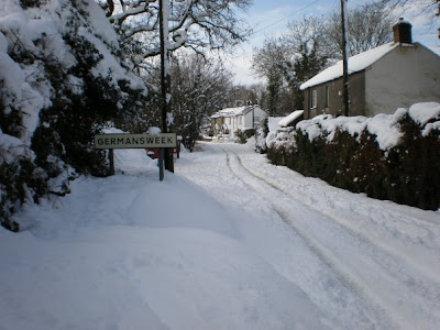
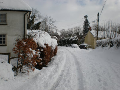
Here's some pictures from Germansweek (from Mr Palmer) and Okehampton (from Mr Smith - Science)!
Okehampton


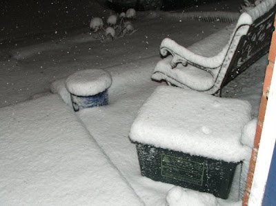
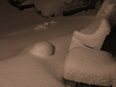
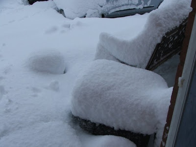
Mrs Fairley has taken these photos of her garden at different times after the snow started falling in Okehampton!
10pm Thursday Evening
 6:45am Friday Morning
 10:30am Friday Morning
Tuesday, 3 February 2009
Tony Cassidy's pop up model of a hurricane
I also photographed Rudi's and Ness's as examples of the finished article...

With thanks to Tony Cassidy for sharing this lesson.
The weather outside is frightful...


The difficult decision was made to send all students home and many staff did the same due to the unpredictable nature of these snow showers. As for me, my journey home was possibly more eventful than the one there! The snow I'd travelled through on the way in was quickly being thawed by the glorious sunshine. However, the snow started again when I got to the 50mph speed limit along the A30. By the time I'd got to the A380 at Haldon Hill, it was heavier than it had been in the morning. Cars were queued for a couple of miles trying to slide their way down the hill towards Exeter. Fortunately I was going the other way. I turned off the dual carriageway onto the Teignmouth road which was thick with snow. I dropped down to 5mph. A car coming the other way had it's hazard lights on and stopped me, saying several cars had skidded into each other further down the road and it was impassable. I did a 3-point turn (of sorts!) and headed back the way I came. I found an alternative route and finally arrived in Teignmouth where the sky was blue and the sun shining - yet 3 miles down the road there were dark skies, snow and traffic chaos!
To keep yourself up to date with the weather for the rest of this week, use the following links...
BBC Weather 5 day forecast for Okehampton
SW England Severe Weather Warnings
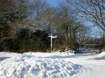
Let us hear your stories of the snow by adding a comment to this post! If you have any pictures of our wintry weather, please email them to me (both students and staff) and I'll add them to the blog.
Here's our first contribution. Mrs Clayton's wonderful snowman...someone has been busy!
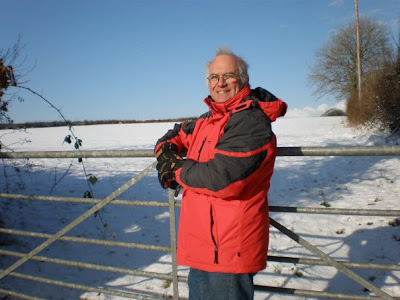
 Here's our next contribution. Thank you Mr Palmer!
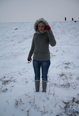
And another one...Ms Murray-Jude this time!
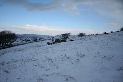
Thanks to Emma Siddall (Year 12) for these pictures of the snow in Sheepwash!

Thursday, 29 January 2009
GCSE Case Study Template
Case Study Template for GCSE
It would be a good idea for you to download an electronic copy as you can then edit it to suit specific case studies. Paper copies will also be available from your geography teacher.
Case Study template now available to download from Okehampton College's new Frog VLE!!
Students click here to go directly to the Frog login.
Saturday, 24 January 2009
Good Luck Year 11 and 13!

Year 11
Don't forget that the DME PowerPoint was posted on here a little while ago if you need it. Think sustainable or unsustainable!!!
Year 13
When discussing the effectiveness of hazard management, remember that their success depends on a number of factors...
- Type of hazard - eg hurricane, earthquake, tsunami, flooding, tornado
- Frequency - how often the hazard happens
- Magnitude - the size of the hazard event
- Spatial/areal reliability - how reliable the management is over a particular space and area
- Speed of Onset - how quickly the hazard starts e.g. earthquakes have a quick speed of onset whereas volcanic eruptions are slower
- Technology available
- Education - is the population aware of what to do in the event of a hazard?
- Preparedness - is the region and its population prepared for the event?
- Economic resources - MEDC? LEDC?
- History - have they learnt any lessons from previous events?
If you need to ask any questions about either exams, add them to the comments at the end of this post and I'll answer them!!!
Thursday, 15 January 2009
Year 9 options: GCSE Geography
To find out more about GCSE Geography, speak to Mr Gurney or Miss Blackmore.
Year 11: Problems with downloading the DME guide
Wednesday, 14 January 2009
Primark hits the news again!
 Primark featured on the BBC News earlier this week for once again being involved in the use of sweatshops, but this time here in the UK! Supplier TNS Knitwear, who supply Primark, was found to be employing illegal workers in poor conditions at its Manchester factory. Factory workers were found to be working 12 hours a day for £3.50 per hour. Primark is best known for its cheap fashion clothing and bucked the trend on Britain's high street last year to make a £233m profit.
Saturday, 10 January 2009
GIS Mission: Wind Power Location
You were set a homework task to have a go at the GIS zone mission on wind power location in preparation for the Sustainability assessment. I will be asking you three questions about the mission that you will only know the answer to if you have completed the task. Once you finish the wind power mission, why not try some of the others!!
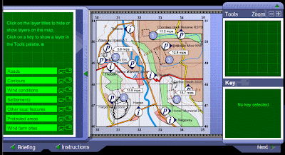 Click here to take you straight to the GIS Missions.


